SISINTA: The digital map that transforms the knowledge of soils into a key tool for production
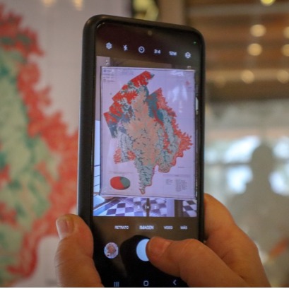
The Inta Soil Institute launched the Soil Information System (SISINTA), a platform that integrates more than 7,000 georeferenced soil profiles from all regions of the country. This digital, free and free access tool allows producers, technicians and decision makers to access precise and updated information on the characteristics and aptitudes of the soil in each territory.
Sisinta (www.visor.inta.gob.ar) combines field and laboratory data with geographical location, allowing searches to be performed by zone or specific attributes. Information can be organized in series or projects, downloading in different formats and being used in analysis software such as calculation forms, statistical tools or geographic information systems (GIS) .In the case of missions, the floor letters of the Guaraní and Leandro N. Alem departments were recently incorporated, with key information for productive planning. In Guaraní, more than 327,000 hectares were relieved, in a project that demanded two years of work and the participation of 30 professionals. Lucas Moretti, Doctor of Geological Sciences and project coordinator by INTA, he explained that this semi -talled cartography allows to calculate the productivity index of each plot depending on different crops. It is a great tool that the producer can access this resource digitally farm and see both the characteristic soils of their location as well as the recommendations for its management, to make decisions based on knowledge, he said. The Guaraní Department, in particular, presents geographical challenges due to its soils in mountain range and pronounced slopes. Thanks to digital maps, it is now possible to identify the different degrees of soil aptitude and their productive potentials with greater precision. With this tool, the INTA is committed to democratizing access to knowledge about Argentine soils, promoting a more efficient, sustainable and adapted agriculture adapted to the particularities of each territory.
IT MAY INTEREST YOU
 Missions | The traditional National Wood Festival in November celebrates four decades of a popular gathering in San Vicente
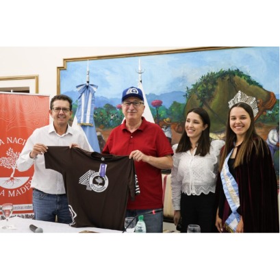
The official announcement of the 4�th San Vicente National Wood Festival was made this Tuesday by the governor of Misiones, Hugo Passalacqua. The cultural and festive event will take place from November 5 to 9 at the Verón Gallardo Sports Center in San Vicente, Misiones, to celebrate four decades of history. The San Vicente National Wood Festival is a popular meeting point for the agroforestry and commercial community in the Alto Uruguay area, and is an opportunity for the forestry-industrial chain to expose its development and services. The festival includes cultural, artistic and economic promotion activities.
 Vida Silvestre and ArgenINTA promote a national consultancy for the restoration of forest landscapes in Argentina
The Argentine Wildlife Foundation and the ArgenINTA Foundation signed a technical cooperation agreement to begin a consultancy aimed at the Restoration of Forest Landscapes (FPR) in the seven forest regions of the country. The work seeks to generate technical and scientific inputs that guide the design of provincial and national restoration programs, in support of the implementation of Law No. 26,331 on Native Forests.
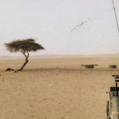 The only tree in the middle of the Sahara desert that was vital for commercial and military routes
The Ténéré Tree, a solitary acacia in the Sahara desert, became for centuries a beacon of life and reference for travelers In the vast Sahara desert, where aridity and silence dominate the landscape, there was a tree that stood alone, being a beacon of life and hope for travelers.