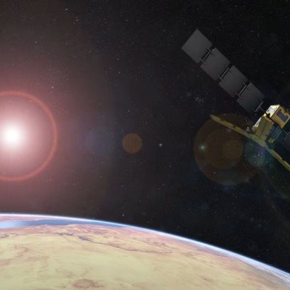
How satellites help measure carbon stored in world forests
A recent study details that these tools manage to monitor large extensions of vegetation and provide relevant information to anticipate changes in global climate
As climate change and human activities alter ecosystems, understanding how much carbon retains trees becomes increasingly more importance for the planet. The ability to monitor these natural deposits is essential to anticipate trends, adopt measures and protect a critical resource in the atmospheric cycle. In that sense, an investigation published in Earth System Science Data explores how satellite data can be used to estimate the amount of carbon accumulated in forests over 15 years. The study is based on information collected by the European Space Agency (ESA), through the Soil Moisture and Ocean Salinity (Smos) mission Tool to monitor the evolution of forest biomass, a factor closely related to carbon stored in vegetation. Carbon absorption is the process by which trees and other plants capture carbon dioxide (CO?) of the air through photosynthesis, they store this carbon in its structure (trunks, branches, roots and leaves) and release oxygen as an oxygen as an oxygen as an oxygen as an oxygen as an oxygen. This mechanism is essential to regulate the concentration of greenhouse gases in the atmosphere and help mitigate climate change. When forests work in a healthy way and grow, they act as natural carbon sinks, so they help to balance emissions that come from human activities such as burning fossil fuels. For this reason, monitoring its ability to absorb carbon is key to designing effective environmental protection and climate strategies. The study represents an advance in carbon monitoring stored in forest ecosystems on a global scale. The results show that the measurements obtained by the Smos mission improve the understanding of how carbon varies in forests over time. The key parameter analyzed in this work is the so -called Optical Dept vegetation (VOD), a measure of the opacity of the vegetation derived from the radiation of satellite detected. As explained by Matthias Drusch, main scientist of terrestrial surfaces in ESA, that indicates the total mass: dry biomass, more water content. It is not a direct measure, but it is very useful. This information allows researchers to generate maps that show how the amount of carbon present in forests is distributed and varied, both globally and local. caution, since the VOD collects both biomass and water content in plants, which forces to analyze the results in the context of the environmental conditions of each area, as Klaus Scipal stressed, responsible for the SMOS and biomass mission. Long term. As the study was carried out: satellite measurement and land research validation is based on the combined use of satellite data and terrestrial observations, which allow validating and refining the results obtained from space. Smos is one of the Earth Explorer program satellites, launched in 2009, which was originally designed to map soil moisture and oceanic salinity. However, the mission significantly expanded its scope by providing measurements applied to the analysis of forest biomass. His main instrument is the Microwave Imaging Radiometer, which operates in the microwave L band. This configuration allows VOD measurement, since the microwave signal penetrates vegetation and suffers an attenuation related to the amount of biological material. The innovative characteristic of the study is to analyze the relationship between the VOD parameter and the actual carbon content through systematic comparison with data obtained on land and with other satellite sources. also a way of interpreting them. That is why we combine satellite data with terrestrial measurements. The idea is to link what we see from space with what happens inside forests and even in each tree. This mixed approach allows strengthening the accuracy of the estimates and ensuring the reliability of the results throughout different scales. The analyzed methodology also relies on the comparison with the data provided by new observation platforms, such as the Biomass mission of that, launched in April 2025. Biomass uses a Pam foliage and offer higher structural details. While delivering a more detailed vision, Smos holds the advantage of having extensive temporary coverage, essential for long -term trends. Trade technologies and future challenges Monitoring of changes in the amount of carbon stored allows identifying regions vulnerable to degradation, droughts or other extreme events with impact on carbon absorption. The combination of sensors and observation techniques, as experts recognize, optimizes the spatial and temporal coverage of monitoring. To elaborate maps without empty, we need to combine several satellites - and that is only possible if we understand well the uncertainties of each one, said Drusch. This data integration is essential for carbon evolution studies, which require both local precision and general vision. Future, the initiative proposes to continue combining the advances of missions to offer an increasingly accurate vision of the State and the evolution of forest resources. Maintaining and perfecting these systems will be key to the monitoring and protection of one of the ecosystems that functions as the main carbon sink on the planet.
IT MAY INTEREST YOU
 We have found the oldest fossil forest on Earth: Tipa de protárboles
Researchers from Cardiff and Cambridge universities found the oldest fossil forest in Great Britain in Britain. Until before this discovery, that title belonged to the remains of another forest found in New York in 2019, which dates back to around 386 million years. This, discovered in 2024, is four million years older.
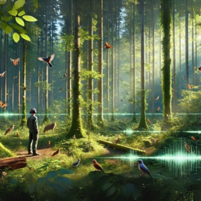 How biodiverse does a forest sound? A study reveals that we can listen to natural wealth
The experiment with photographs and forest sounds showed that people are able to identify how much biodiversity there are just observing or listening to walking through a forest is a multisensory experience. The intense green of foliage, the light filtering between the branches, the bird choir at dawn. But how much do we really capture the biodiversity that surrounds us?
 Value Forestry Engineering | The redfor.ar launches the Week of Forest Sciences throughout the country
With virtual and face -to -face talks, from August 11 to 16, an open call to young people, students, researchers, teachers and the general public will be held in the countrys forestry faculties. The proposal is framed in the Forest Sciences Week: an invitation to connect with our forests, in order to know the goods and services they provide, to assess them.